Collision or Coordination? The Mobility Crossroads at Navi Mumbai’s Port-Airport Corridor
by Tejasvi Sharma, Editor-in-Chief, EPC World
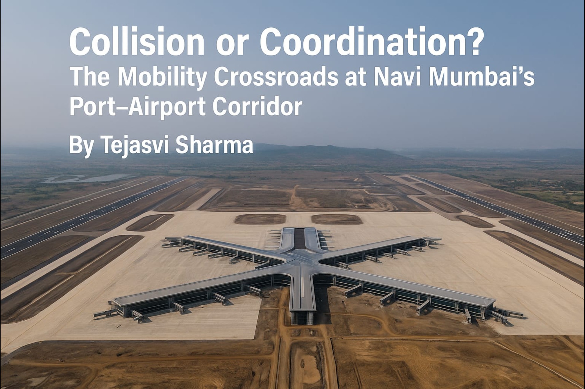
As dawn breaks over the glistening Arabian Sea, the coastal city of Navi Mumbai stirs to life. Trucks laden with containers groan down NH-348, threading their way from the Jawaharlal Nehru Port Trust (JNPT), India’s busiest container port. Simultaneously, cranes tower over Ulwe as the final girders fall into place at the much-anticipated Navi Mumbai International Airport (NMIA), poised to welcome its first flight by late 2025.
But beneath the optimism of progress lies a fundamental question: Can Navi Mumbai’s transport infrastructure absorb the thunder of trucks and the roar of aircraft – without grinding to a halt?
A Mega Collision of Corridors
The coming years will place Navi Mumbai at the heart of India’s trade and travel grid. JNPT already manages nearly 56% of India’s container traffic, with over 5,000 trucks entering and exiting daily. With NMIA aiming to handle 60 million passengers annually by 2035, the stakes are rising.
Both megaprojects draw their lifeblood from the same arterial roads: NH-4B, the Sion-Panvel Expressway, Amra Marg, and the soon-to-be-operational Mumbai Trans Harbour Link (MTHL). When freight and fliers clash on these common conduits, what follows could be a logistical nightmare – unless systems are smartly integrated.
Kalamboli, a dense junction point near Panvel, already sees long tailbacks. Add airport traffic, and this bottleneck may turn into an urban chokehold.
Bridging the Future: MTHL and Beyond
On a misty morning in January 2024, the Mumbai Trans Harbour Link – India’s longest sea bridge – was opened to the public. Spanning 21.8 kilometers from Sewri to Chirle near Uran, the bridge slashed commute times from South Mumbai to Navi Mumbai to just 40 minutes. For a while, it seemed MTHL would be the panacea.
But cracks in that optimism are already surfacing. The bridge currently excludes heavy trucks, pushing port-bound cargo to older, congested roads. And while MTHL connects Mumbai to Navi Mumbai, it doesn’t yet connect NMIA directly to JNPT, despite both being within a 25 km radius.
This is where the Coastal Highway Project steps in – a 7 km corridor being developed by CIDCO to link Ulwe with JNPT. If completed by 2026 as scheduled, it could serve as a vital bypass, siphoning off freight and reducing airport approach congestion.
The Railway Renaissance
Further south, steel tracks gleam in the sun. The Uran line, part of Mumbai’s suburban railway expansion, now links JNPT with Belapur. This holds immense potential – not just for workers commuting from the city, but for shifting light freight off the roads.
Meanwhile, the Mumbai Metro Gold Line (Line 8) is slated to link NMIA with the existing Chhatrapati Shivaji Maharaj International Airport (CSMIA). Imagine a 30-minute metro ride across the metropolis, bypassing road snarls altogether – a boon for time-sensitive flyers.
But here too, the devil is in the delivery. Delays, land acquisitions, and budget mismatches threaten to slow progress. Without this crucial link, passengers might have to brave a multi-hour road trip between airports, diluting the efficiency gains NMIA promises.
Waterways: The Underused Ace
It’s the sea, however, that may offer the most elegant solution. In a quiet creek near Karanja jetty, trial runs for water taxis are already underway. These crafts, once operational, will carry passengers from Mumbai’s Gateway of India and Mandwa directly to jetties near NMIA – in just 40 minutes.
Imagine a business traveller boarding a catamaran at Colaba and gliding through the sea breeze to check-in at NMIA – completely bypassing road traffic. Or barges carrying JNPT containers to south Mumbai’s docks, sparing highways their daily truckload stress.
In an era of rising carbon footprints and shrinking urban space, the maritime route is not just faster- it’s smarter.
The Real Test: Integration
Despite the infrastructure blitz – MTHL, coastal highways, airport express metro, and port rail extensions – the real challenge lies in synchronization.
Can CIDCO, JNPT, NHAI, and the Maharashtra Maritime Board align their timelines? Can systems be designed to allow intermodal transfers – from ship to train to airport terminal -in minutes, not hours? Will digital traffic control systems predict and redirect flow in real-time?
As of now, the answer remains uncertain.
A Fork in the Road
The coming decade will define Navi Mumbai not just as an infrastructure marvel, but as a case study in urban mobility. It can either become a seamless, synchronized multimodal transport hub – or descend into a cacophony of clashing corridors.
The port and airport, the two lungs of India’s trade and transit, must breathe in rhythm. And that requires not just engineering feats- but institutional harmony, digital governance, and a bold embrace of waterways.
As Tejasvi Sharma writes for EPC World: “The question isn’t whether Navi Mumbai can build more. The question is whether it can connect smarter. The future lies not in concrete alone – but in coordination.”
Tags
Related Posts
